Wildfire Situational Awareness: 2020 Outlook
Add bookmark
We respect your privacy, by clicking "Download Your Copy" you agree to having your details passed onto the sponsor who may promote similar products and services related to your area of interest subject to their privacy policy. You have the right to object. In addition, you will receive our e-newsletter, including information on related online learning opportunities. For further information on how we process and monitor your personal data, and information about your privacy and opt-out rights, click here. Download PDF Attachment
A conversation with Alan DeCiantis, Director of Product, FTS Inc. on the evolving role technology plays in wildfire prediction, prevention & mitigation.
To start, can you tell us a bit about yourself and your company, FTS?
I started in 2014 as Director of Product for FTS, moving from Ontario to the beautiful west coast.
Prior to FTS, I held similar positions at BlackBerry, Nikon, and Magna. My team’s responsibilities include product management, marketing, strategic partnerships and supporting business development.
FTS has been serving the global wildfire community for 40 years, with reliable and innovative environmental monitoring solutions for extreme environments. What began with wildfire preparedness, providing remote automated weather stations (RAWS) and data to help calculate the National Fire Danger Rating (NFDRS) codes. Has expanded to include wildfire behavior solutions, such as lightning detection software, cameras, mobile weather stations and portable air quality sensors.
In January 2019, FTS became part of the Advanced Environmental Monitoring (AEM) family of innovators. We continue to support and service the wildfire community, the same as we have since our incorporation in 1980.
FTS has been a key player in the industry for decades now. What key wildfire management trends and challenges are you seeing/hearing about in 2020?
As part of our ongoing strategic planning, we are always engaging with wildfire industry experts and monitoring larger market trends very closely. The three most prominent ones that we have been responding to over the last few years are cameras, weather station network density and air quality. Plus helping to build a common operating picture across the wildfire and emergency responder organizations to take all of the data from above technologies, aggregate it and display it via customizable, user-friendly dashboards.
Where does wildfire situational awareness come in? What is it, what does achieving it require, and what role does it play in wildfire management response and prevention?
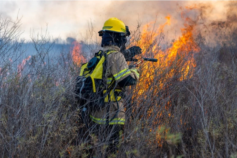
Situational awareness is perceiving environmental events, comprehending their meaning, and most importantly projecting their future trend and potential impacts. Situational awareness comes into play at all stages of a wildfire event lifecycle. From preparedness to detection to initial response to suppression, mop up and reclamation.
The wildfire community are already experts at situational awareness, the best way we can help them is by listening to their needs as environmental trends continue to change and bring innovative solutions for their consideration. For example, a remote automated observation system (RAOS) with a daytime and thermal camera can be placed anywhere around a wildfire for 24-hour monitoring where it may not be safe for air or ground personnel. In some regions where wildfires are common each season or in anticipation of a lightning event in fire-susceptible areas, a RAOS can provide visibility in place of sending out more costly aviation patrols. Aviation patrols are highly effective, but the limitation is aircraft flight range (fuel) and can only detect if the aircraft is within range at the time of the flight. The RAOS cameras are a lower costs option that can be programmed to provide and maintain vigilance in these areas.
Many wildfire organizations are experiencing a heavier workload when it comes to large, aggressive fires and the additional smoke that comes with that thwarts the necessary initial attack and ground support functions of air operations. If the skies are full of smoke, many organizations will simply cease air operations for hours sometimes day, meanwhile the fire is getting larger. Having visibility of the areas of concern can provide for contingency planning to attack using alternative ground forces where air support cannot reach until the smoke clears.
Fuels management is a big component of mitigating extreme wildfire behavior; understanding where the fuels are most likely susceptible to ignitions and to demonstrate extreme fire behavior once it gets going. The fixed and portable weather stations can provide greater insights into this area.
Situational awareness can often look a bit different for firefighters on the ground in comparison to incident commanders who are at command centers. In what ways does FTS help bolster the connection between the two with regards to situational awareness?
The FTS360 software provides reliable, secure, real-time information from stations, cameras, lightning detection, and many other data inputs. As a responsive web platform, the same information on a big screen in the command center appears on a mobile device. The FTS360 mobile app allows offline configuration of stations and cameras on the ground, that auto synchronizes with the web platform afterward.
The FTS incident remote automated weather station (iRAWS) for US fire fighters comes equipped with text to speech (TTS) capability over the same handheld radios the fire fighters carry. The iRAWS is placed on the fire line where fire fighters can request current weather conditions or receive alerts about changes in weather conditions to help keep them safe.
Aerial firefighting operations can also benefit from this technology. With wildland urban interface fires or wildfires in remote areas of concern are responded to very quickly with aircraft. If pilots and air operations personnel have visibility of the site-specific weather data, they can make more informed decisions ‘on-the-fly’ for what is the most appropriate tactic or support requirements. Aviation is costly and comprises approximately 50% of many wildfire suppression budgets; requesting additional tanker groups versus only a single resource like a helicopter with a firefighting bucket or belly tank can make the difference in not only effectiveness but also costs.
When it comes to achieving wildfire situational awareness, what are some of the major capability gaps or areas of improvement you see out in the field and why is it vital they be addressed ASAP?
The wildfire community are experts at what they do. Their training and experience prepare them to assess the data and make the critical decisions that can impact lives and property. As technology evolves and more sources of data are made available, it is important to ensure they are relevant to the wildfire communities needs and presented in a way that supports their decision-making processes.
Preparedness is very important, ensuring NFDRS fire codes can be calculated based on a network of RAWS is the first step. Building on this network with infill stations that are compact, economical and provide reliable data that can be ‘trued up’ using the RAWS network strengthens the NDFRS model.
Equipping the Emergency Management community with compact, easy to use, even mobile weather stations like the Intellisense MWS can be another key source of data to support the overall situational awareness picture.
Increased public demand for air quality information during fire season and the recent change in legislation requires local measurements by portable automated stations that can be easy published by the Air Resource Managers (ARA’s) assigned to the fire.
Similarly, many wildfires especially wildland urban interface fires (WUI) are very public and the demand from the people and the media to report it correctly is very important. Decisions around public safety hinges on accurate field data, for example extreme wildfire weather advisories or the need to issue evacuation alerts and notices to a community.
With many jurisdictions experiencing more aggressive and longer wildfire seasons, this comes with more wildfire suppression resources at play; thousands of wildland firefighters, structural firefighters, ground and air support personnel and equipment. To best utilize resources, it starts with knowing where they are assigned, when they relocate and when they need to be pulled of an incident to get rest and then be re-assigned. Fatigue plays a leading cause in most incidents and accidents, so using technology to better track operational periods for personnel is an area that many wildfire agencies can agree that more technology developments would help them improve efficiencies and safety.
What are some of the ways technology enhances and enables situational awareness?
Underlying technologies in FTS360 like MQTT make it possible to intelligently curate existing and new sources of data together, bringing the highest value to the critical decision makers. MQTT works much the way social media does, by allowing publishers and subscribers of data to engage on a topic without knowing anything about each other except the topic they are both contributing to. Station ID, camera IP addresses, data base formats, mobile device type are no longer limited factors for engagement, the MQTT broker manages the near infinitely scalable topic conversation at near real time, like social media.
AI/ML provide significant opportunity to allow network scaling particularly for cameras. As imagery is collected in FTS360, testing with AI reveals that imagery can be analyzed and recognized elements such as personnel, vehicles, fire, smoke etc can be used to provide a curated output including imagery with weather and AI analysis overlay as context for assessment and/or automated alerting.
What about big data and analytics? How does FTS and its partners harness data to better understand, predict, and defend against wildfires in real-time?
Big data and analytics are an important part of situational awareness. Our sister company Earth Networks automatically processes 25 terabytes (~8,300 Netflix HD movies) of data per day. As part of AEM, we can now offer lightning detection through FTS360 as well as customized weather forecasting to the wildfire community using big data.
Do you have any other, specific examples of how government agencies are using FTS situational awareness tools to more effectively identify and mitigate forest fires?
Australia’s Bushfire State Communities use iRAWS and FTS360 to communicate to their teams and command centers. Built within the FTS360 architecture is NodeRed, a powerful visual based programming tool for end users (or FTS) to setup advanced data processing, transmissions, and complex alerting. The Australia Bureau of Meteorology receives the same wildfire data from the iRAWS, but in very specific formatting so it can be incorporated into their federal forecast models. Data formatting, transmission, alerting and other changes can be made directly in NodeRed without any changes to the FTS360 software.
Where do you see the future of wildfire situational awareness going? How do you see the technology evolving to meet the demands of a world that is increasingly at risk for wildfires?
In many cases, wildfire community policy and procedure updates will provide the priority for new technology adoption. What the wildfire community does is serious business and anyone providing solutions to support them must deliver reliable, accurate, curated data faster to help them protect lives and continually improve public awareness.


